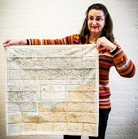
The map belongs to the category of maps called Evasion-and-escape maps. The Allies made these maps during World War II and printed them on silk and rayon (artificial silk). The British evasion-and-escape agency Military Intelligence 9 (MI-9) and its American counterpart Military Intelligence Service's Evasion and Escape Section (MIS-X) collaborated on this. The British focused on maps of European territory. The soldiers received these maps in their military kit and were meant - if necessary - to help them escape.
For those maps that had to be hidden really well, the brain behind the MI-9 evasion-and-escape tools, Christopher Clayton Hutton, had chosen a Japanese paper (so-called mulberry tissue) to print maps on. These could be folded up so small that they could be hidden in a hollowed-out pencil.
The great advantage of these maps is that they do not mind getting wet and they do not make a treacherous crackling sound. Escape maps were also sent to prisoners of war between playing cards or hidden in the well-known Monopoly game.
How did the University Library acquire this map?
At the time, many of these cards were made: in 1942, MI-9 had already issued 209,000 cards. Although they are still for sale on websites like eBay for very different amounts, you do not find them very often. I found this one in an antique shop in Bredevoort and bought it for 1 guilder.